
Hampden update - Catastrophe event hurricane Beryl
Hurricane Beryl made history on 30 June for becoming the first Category 4 hurricane to form in June. The hurricane began on 28 June as a tropical depression with wind speeds of 34.5mph, which intensified to a Category 4 hurricane in just 42 hours by 30 June with wind speeds estimated at 120.8mph. It was also unusual in its very southerly position with Hurricane Allen in 1980 and Hurricane Ivan in 2004 the only major hurricanes on record in this vicinity.
The hurricane caused extensive damage when it made landfall on 1 July on Carriacou Island in Grenada, an island with a population of 10,000 people. In the early hours of 2 July, record warm waters and ideal atmospheric conditions allowed Beryl to strengthen into a Category 5 hurricane (165mph) entering the Caribbean Sea, making it the strongest in July, surpassing Hurricane Emily (160mph) in 2005 before beginning to weaken to a Category 4 hurricane. Severe winds, storm surge and heavy rain affected many adjacent countries including Venezuela, the Dominican Republic and Haiti.
On the evening of 3/4 July severe hurricane force winds hit the south coast of Jamaica with winds of up to 145mph. The capital city of Kingston suffered a large storm surge, which resulted in 400,000 people without power. The significant winds missed Kingston, with the rural southwestern portion of Jamaica being the most affected. Hurricane Beryl was the strongest hurricane to hit Jamaica in decades putting the Jamaican Government’s $150m International Bank for Reconstruction and Development’s cat bond at risk of triggering a pay-out, although reports suggest the minimum central pressure was not high enough to trigger a pay-out. Broker BMS estimates insured losses in Jamaica of $200m.
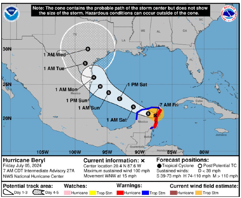
The Cayman Islands have experienced tropical-storm force winds and the hurricane has now made its way as a Category 2 hurricane towards the Yucatan Peninsula making landfall northeast of Tulum on the morning of 5 July. A slow re-intensification is expected on the evening of 5 July as it moves over the Gulf of Mexico with its impact likely to be felt in Mexico and possibly Texas where it is expected to weaken to Category 1 strength.
Hampden comment: It is too early to determine exact loss figures for Beryl and further impacts are expected in Mexico and possibly Texas. However, Beryl took a “lucky” track through the Caribbean as the more heavily populated islands of Grenada and St Vincent saw much less intense winds and seemed to have incurred relatively little damage. Broker Aon reports that economic losses are currently estimated to be in hundreds of millions of US$ with insured losses expected to be significantly lower. However, damage across already affected areas is still being assessed.
Expectations this year are for an active hurricane season with the Pacific basin heading from the warm seas of El Niño to the cool seas of La Niña while the Atlantic basin remains warm. Both conditions typically enhance hurricane activity. Hurricane Beryl is the first evidence so far this year breaking a series of records including being the earliest land falling major hurricane on record just ahead of the Gulf Coast Hurricane on 5 July 1916. Tropical Storm Risk has increased its hurricane season projections as of 5 July to a total of 13 hurricanes this year, though the important factors for insured losses are how many hurricanes make landfall, the intensity of the storm and the landfall location.